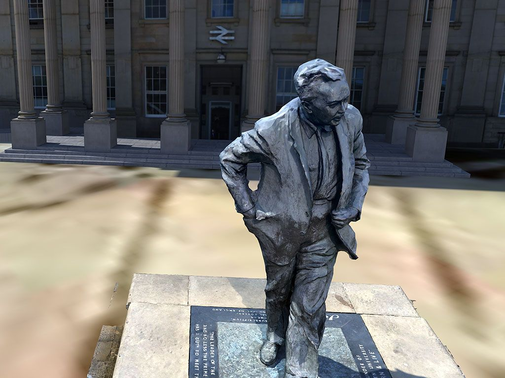
I made a photogrammetric capture of the well-known statue of Harold Wilson, situated outside Huddersfield railway station on Saint George’s Square, early in the project. Using Polycam alone, the results were satisfactory, and I decided to expand the experiment in several directions. I utilised the 3D model to create an annotated VR infographic on Sketchfab then imported it into Mozilla Hubs alongside a set of 360-degree images of the spherical capture of the square where the statue is located. Later, while experimenting with GIS data and open-source mapping, I discovered I could recreate the geographical area in three dimensions. Although the Mozilla Hubs version was lost when the platform was deprecated, I was able to create a composite environment using the statue in SketchUp.
Feelings
This is a project that I began to undertake using Polycam, and it immediately convinced me of the software’s utility, power, portability, and ease of use. It was immediately clear that this tool could be used to rapidly capture objects with news value in any situation. However, it also became clear that creating the spaces these objects might inhabit would be more difficult. One approach that I developed later in the process was based on the use of drone footage, and that might be an approach I return to. Using 360-degree photography and scaling the model inside a photosphere gave interesting results but was ultimately unsatisfying. So, some of that initial enthusiasm for the approach diminished over time.
Evaluation
This particular challenge, the marrying of objects that could be effectively and quickly captured using photogrammetry with spaces that cannot, would become a core challenge of the practical research. It was only when I discovered approaches based on open-source data that there was a resolution for this. And even then, my conclusion is that spaces like St. George’s Square, which are large and open, can and must be rendered using a variety of techniques. For example, a combination of GIS data, photogrammetry, and the use of a skybox (projected dome of sky over the area) could be deployed to convincingly create that space. Even then, the functional area that players navigate would need to be reduced to just those parts of the model that are necessary to tell the story, while the background and our access to it will be constrained by rules.
Application
It was disappointing to lose a version of the work with the deprecation of Mozilla hubs, and this did put a dent in the progress with this element, which lay dormant for some time. However, the ultimate takeaway is that a combination approach is viable, can work, and is accessible if packaged as a particular workflow that can be used for spatial journalism.
Conclusions
From this experimentation, a potential workflow for creating open areas that contain elements of newsworthy scenes emerged. This approach, which combines photogrammetry, GIS data, and 3D modelling techniques within game engines, opens up a world of possibilities for spatial journalism. It could lead to the creation of large open areas that seamlessly transition through an amalgam of several smaller models as users change points of view within the scene. As a proof of concept, it’s not just compelling, it’s inspiring, and it sets the stage for exciting future developments in the field.