CADMapper draws on data from open and proprietary datasets to enable users to generate maps and models of 3D terrain that can be imported into CAD and 3D modelling tools, including SketchUp. It does a similar job to the SketchUp extension Moduler when combined with GIS data. The critical difference is that CADMapper generates entire 3D model files that are ready to download and open using various 3D editing tools. It is entirely free to create tiles, but with a limit of one-kilometre square. In addition, CADMapper also has access to a selection of pre-generated models of cities that can be downloaded for free. Although this is not open-source software, the free access is generous enough to develop and create spaces quickly without cost.
Feelings
CADMapper is a scarce thing on the current Internet: something for nothing. It is also highly configurable, enabling you to add the level of data that you need and want in a particular situation and then download and edit that data. However, it still has some limitations compared with other solutions, like Moduler.
Evaluation
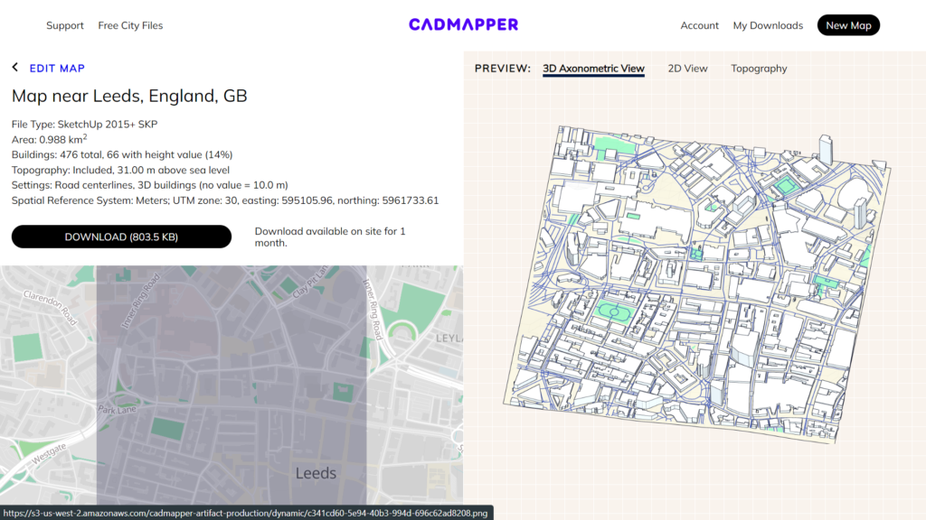
CADMapper enables users to create data files to load into SketchUp in minutes. Once inside SketchUp, users can edit individual layers, which are all helpfully labelled according to the type of content on that layer. For example, all buildings exist on one layer, all railways under another, all waterways on another, and so on. Because you can access individual layers in this way, you can colour code each layer rapidly, developing a 3D model space that can easily be imported into a VR platform like Spatial.
Although the dataset is more complete and draws on more sources, it is still better in highly populated areas than in rural or village locations. When we try to output models with less granular building data, the houses and churches appear as generic boxes. Again, like Modelur, this may give us a good enough start to add detail to a particular area vital for telling a spatial story.
Application
CADMapper is suitable for fast prototyping of real places, particularly areas of towns and cities. It enables you to create a volumetric model of a geographic area very quickly, and the 1km restriction doesn’t impact journalistic applications of the program.
It could be used for quick responses to immersive news reporting, offering a chance to quickly generate an area that can then be populated with narrative objects.
Conclusions
Our reservations about using CADMapper are that it is an online service rather than a standalone piece of software. As such, it is prone to instability and may disappear at any time, should the developers wish to switch off the service. That means that although it is helpful in fast immersive reporting workflows, it cannot be relied upon forever.
However, its frictionless and fast output makes it a good tool for quickly generating virtual representations of real spaces.